
Central Pearl River Water Trail
Have you paddled the Pearl? CONTACT PEARL RIVERKEEPER with paddling route submissions, edits, suggestions or any other relevant information for our Water Trail in progress. Thank you!
|
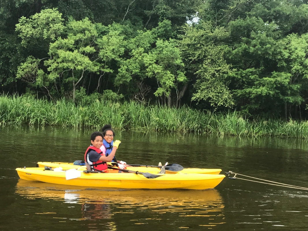
Section 1: Ross Barnett Reservoir Spillway Dam to LeFleur's Bluff State Park Ramp: 10.4 miles*
PUT IN: Ross Barnett Reservoir Spillway Dam LAUNCH/LANDING: Concrete boat ramp DESCRIPTION: Large parking area on both sides of the river just below the Ross Barnett Reservoir Spillway Dam off Spillway Rd. Restrooms and lighted parking lot. Popular fishing location. CHECKPOINTS (mileage and checkpoints mirror the "Pearl River Paddling Trail" developed by Mississippi's Lower Delta Partnership* 1) Ross Barnett Spillway Dam 2) Mouth of Old Pelahatchie Creek - Mile 0 3) Old Channel Lake & Wetlands - Mile 0.5 4) Mule Jail Lake - Mile 1.2 5) Brashears Creek - Mile 1.4 6) Cove and wetlands - Mile 3.4 7) High sandbar - Mile 3.5 8) High sandbar - Mile 4.1 9) River Lake - Mile 4.3 10) Water intake structure - Mile 4.5 (WARNING! Avoid the pylons supporting the water intake structure, especially during fast (high) water.) 11) High sandbar - Mile 5.0 12) Purple Creek - Mile 5.3 13) Small sandbar - Mile 5.4 14) Hanging Moss Creek (new mouth)- Mile 5.8 15) Hanging Moss Creek (old mouth) - Mile 6.8 16) Sandbar - Mile 7.5 17) Twin Lakes Creek - Mile 8.8 18) Lakeland Dr bridge - Mile 8.9 (WARNING! Be cautious paddling near concrete bridge supports especially during fast (high) water.) 19) Prairie Branch Creek - Mile 9.8 20) LeFleur's Bluff State Park Ramp - Mile 10.4 TAKE OUT: LeFleur's Bluff State Park Ramp (Mays Lake): 3315 Lakeland Terrace, Jackson, MS LAUNCH/LANDING: Concrete boat ramp DESCRIPTION: Primitive and RV camping with restrooms, fishing, hiking, and bird watching. 9-hole golf course, driving range and frisbee golf course. Day use entry fee $4. WARNING! Dangerous Low Head Dam 1/2 mile below take out. This dam is not navigable by boat. *For more information on paddling the "Pearl River Paddling Trail" (Ross Barnett Reservoir Spillway Dam to LeFleur's Bluff State Park Ramp), please visit the website for Mississippi's Lower Delta Partnership or Paddling.com. |
DETAILS: "Easy day trip suitable for beginners in low to medium water. Not recommended for beginners in high water."*
TIME: 4-5 hours during low-medium water level WATER LEVEL: For current water level reading, check the Pearl River Gage at Highway 80. <5 feet, very low, numerous shoals and steep banks 5-10 feet, low, slow water 10-20 feet, medium, best paddling 25 feet, high, bankfull 25-30 feet, high to very high, fast water and dangerous snags |
|
Section 2: Crystal Lake (oxbow lake, no river access), Flowood Dr, Flowood, MS
DESCRIPTION: Concrete boat launch with ample parking, fishing piers, picnic areas and restrooms. "This facility is nestled in a highly traveled area just off Flowood Drive, and is home to many anglers and picnic goers. It has two main picnic areas complete with tables and trash receptacles, restroom facility, two handi-cap fishing piers, and a newly renovated boat launch. It has seen activities such as MS Wildlife and Fisheries Kid’s Fishing Rodeo and Boy Scout Retreats." City of Flowood More information: Kayak JXN and video of Crystal Lake at Sunset |
|
|
Section 3: Currently no access points from the Low Head Dam at the Jackson Water Works to Georgetown Bridge, 66 miles
|
|