Impaired Waterways
DESIGNATED USE
|
The EPA requires each state to give all of its waterways a "Designated Use", specifying goals and expectations for how a state waterway will be used and the associated Water Quality Standards (WQS) that must be maintained. The WQS vary depending on the waterbodies "Designated Use".
"Designated Uses" in Mississippi include:
|
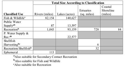
Source: State of Mississippi
Water Quality Assessment 2020 Section 305 (b) Report
|
IMPAIRED WATERWAY
Click to view State of Mississippi
Water Quality Assessment 2020 Section 305 (b) Report
|
MS Department of Environmental Quality (MDEQ) conducts surface water assessments to collect data on waterbody health and then compares that data to the state's Water Quality Standards (WQS). If a waterbody's assessment does not meet the WQS set by the state, then the waterbody is listed as "Not Attaining" one or more of its "Designated Uses". When testing indicates non-attainment of a "Designated Use", the waterbody will be placed on the Mississippi Section 303(d) List of Impaired Water Bodies.
Causes of "Impairment" include:
|
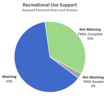
80 Pearl River waterbodies are listed as "Impaired" for intended use
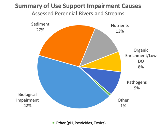
Source: State of Mississippi
Water Quality Assessment 2020 Section 305 (b) Report
TOTAL MAXIMUM DAILY LOAD (TMDL) CALCULATION
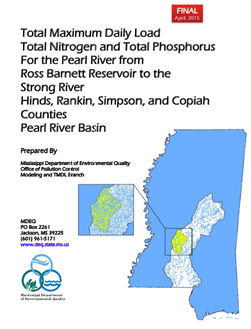
Click to view TMDL
|
When a waterway is put on the Section 305(b) List of Impaired Water Bodies, a Total Maximum Daily Load (TMDL) study must be performed. A TMDL is the calculation of the maximum amount of a pollutant allowed to enter a waterbody so that the waterbody will meet and continue to meet water quality standards for that particular pollutant. A TMDL could lead to potential regulations to limit further contamination or changes to the waterbody's NPDES permitting.
According to the EPA, waterbody restoration and TMDL success depends on engaged citizens: "Citizens are encouraged to become involved in maintaining or restoring waters in their neighborhood. Local communities often have a personal stake in the fate of the water. Residents and local businesses can help identify critical issues, set priorities and preliminary goals, assist decision-makers, or initiate and implement restoration activities at the ground level. One way to get involved is by starting or joining a watershed, lake or river association. These associations can provide opportunities to monitor water quality, identify pollutant sources and recommend viable pollution control actions." |
State of Mississippi
Water Quality Assessment 2020 Section 305 (b) Report
|

State of Mississippi
Water Quality Assessment 2020 Section 305 (b) Report
|
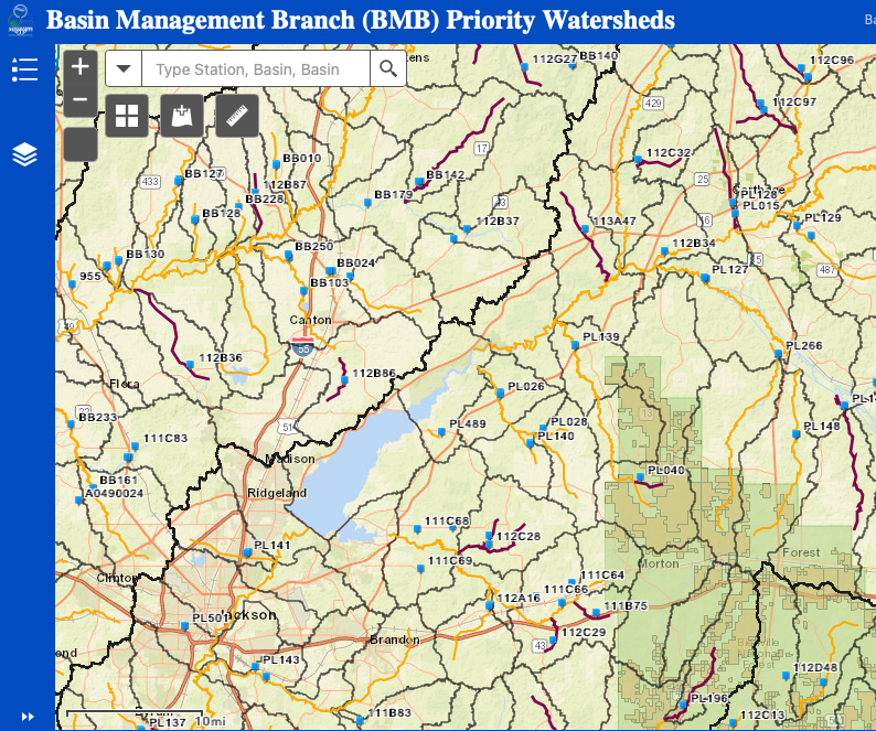
MDEQ Mapping Tool
Click below to access MDEQ's ArcGIS mapping of all MS waterways. Use the "Layer Options" tab to view Point Sources, Impaired Waters, Water Designated Uses and more.
Click below to access MDEQ's ArcGIS mapping of all MS waterways. Use the "Layer Options" tab to view Point Sources, Impaired Waters, Water Designated Uses and more.
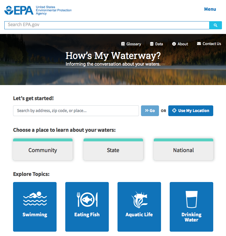
EPA HOW'S MY WATERWAY?
Click below to access another powerful mapping tool that provides information about the status of any US waterway with regards to swimming, eating fish, aquatic life, drinking water, monitoring, identified issues, restoration and more.
Click below to access another powerful mapping tool that provides information about the status of any US waterway with regards to swimming, eating fish, aquatic life, drinking water, monitoring, identified issues, restoration and more.