Low Head Dams/Sills
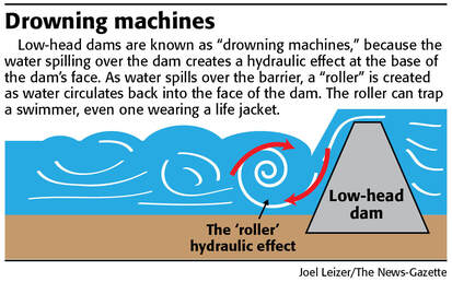
Low Head Dams/Sills/Weirs are underwater concrete barriers placed along the width of a river to regulate flow, usually resulting in a change in the height of the water level. These dams are often difficult to detect from up-river and may not appear to be dangerous to boaters or swimmers. The hydraulic forces and recirculating currents are in fact extremely hazardous and can swamp boats and drown swimmers. CBS News reported: "Since the 1950s, at least 441 people have died at 235 low-head dams in 38 states, according to researchers at Brigham Young University". A 12-year-old swimmer drowned at the Leake County low head dam on the Pearl River in June 2017. Even on small rivers, the force of the bankroller created by the sill/dam can trap watercraft and pull boaters underwater even while wearing a flotation device.
Lowhead Dams on the Pearl River:
*Extreme caution should be taken when recreating in the vicinity of these dams/sills.
Lowhead Dams on the Pearl River:
- Leake County Water Park in Lena, MS on the Upper Pearl
- Jackson Waterworks, south of LeFleurs Bluff State Park Boat Ramp
- Poole's Bluff Boat Launch near Bogalusa, LA
*Extreme caution should be taken when recreating in the vicinity of these dams/sills.
 USFWS Gulf Sturgeon Study
In addition to the drowning hazards posed by the dams/sills, these structures have a detrimental and lasting impact on the ecology of a river system. In 1935, the U.S. Army Corps of Engineers (USACE) "Pearl River Navigational Channel" project dredged a 20 mile canal with 3 locks from south of Bogalusa to the mouth of the West Pearl River. In the 1950s the USACE built 3 low head sills (one at Pools Bluff south of Bogalusa, one at the Bogue Chitto River and one at the spillway) to help maintain water levels in the Canal. Louisiana Department of Wildlife & Fisheries has reported that these sills have "altered the historic migration routes and the overall life cycle of 18 fish species, including the Gulf Sturgeon and Alabama shad". In 1995, the West Pearl River Navigation Project and associated sills were placed in "caretaker" status and, according to their website, USACE was directed by Congress to use limited funds to maintain the Project in that status.
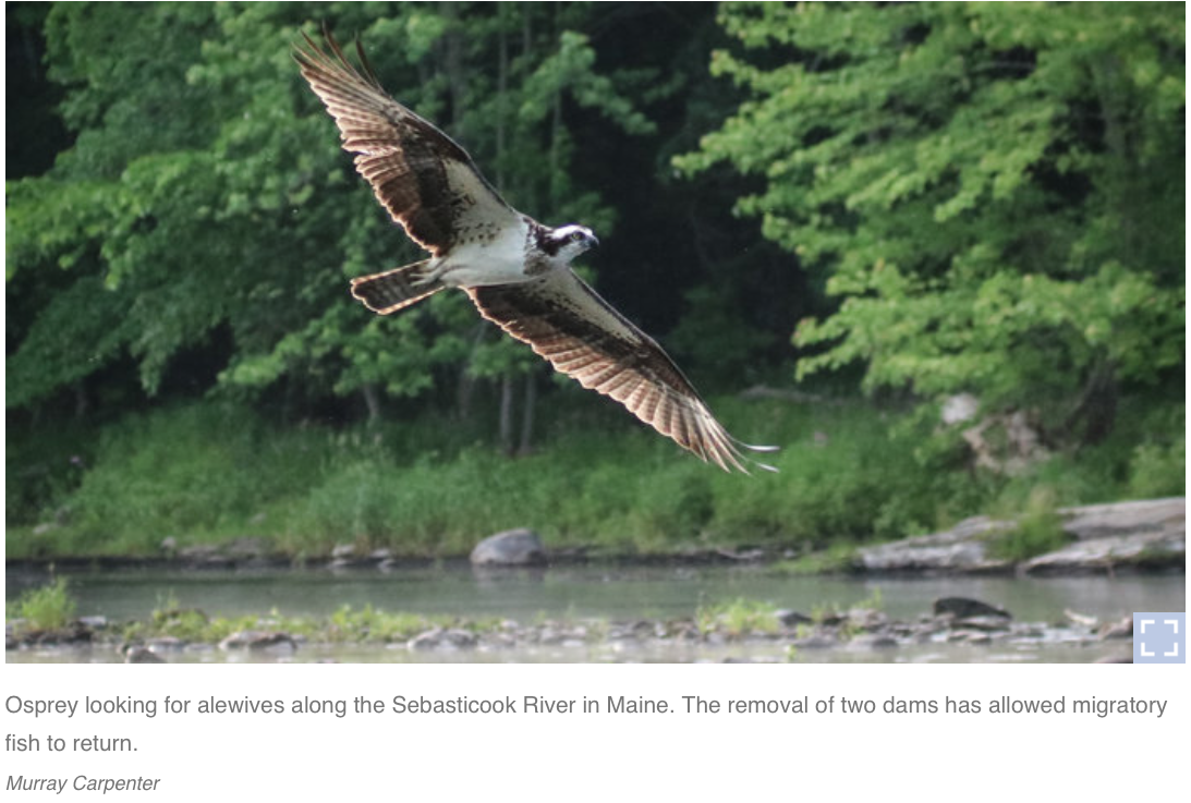
Throughout the United States, dams/sills are being removed to allow rivers to resume their natural course. Click below to access an amazing story about "A River Transformed After Dams Come Down"
Throughout the United States, dams/sills are being removed to allow rivers to resume their natural course. Click below to access an amazing story about "A River Transformed After Dams Come Down"