
MDEQ Office of Geology Maps
 Geologic Map of the Edinburg Quadrangle, Neshoba and Leake Counties, MS. Geologic Map of the Edinburg Quadrangle, Neshoba and Leake Counties, MS.
|
Courtesy MDEQ Dept of Geology
|
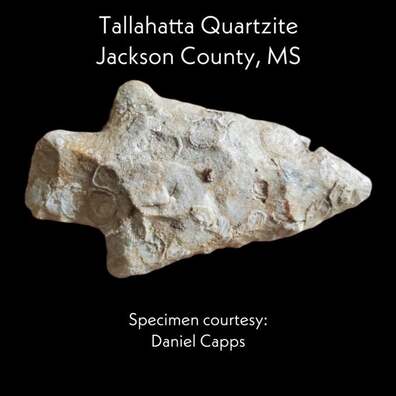
Map depicts the Headwaters of the Pearl River as it travels through the MS Band of Choctaw Indians' land in Neshoba and Leake counties. In this region, the Pearl River cuts through the geology of the Tallahatta Formation comprised of shallow-marine deposits abundant with Thalassidoides, trace fossils of burrowing shrimp. This region's outcrops of high-quality orthquartzite, called Tallahatta Quartzite were utilized and traded heavily by native cultures that lived along the Pearl River dating back to the end of the last ice-age.
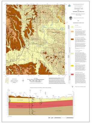
Geologic Map of the Pearl River Quadrangle, Neshoba County, MS.
|
|
Map depicts the Pearl River near its headwaters in Neshoba County, MS. Geyser Falls Water Theme Park owes its natural elevation changes due to the geology of the Tallahatta Formation depicted on this map. The ichnofossils that are prevalent in this Formation can be found on display throughout the water park. Ichnofossils, or trace fossils, are fossil records of biological activity like burrows or footprints but not the preserved remains of the plant or animal itself.
|
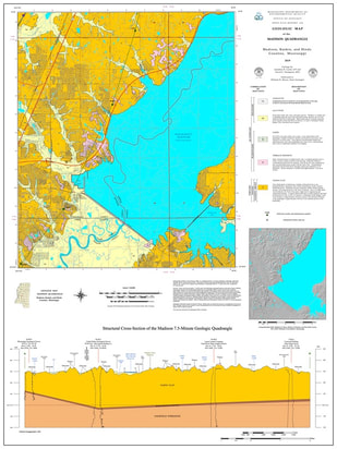
Geologic Map of the Madison Quadrangle, Madison, Rankin and Hinds Counties, MS
|
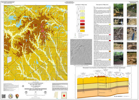
Geologic Map of the Ridgeland Quadrangle, Madison and Hinds Counties, MS.
|
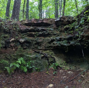
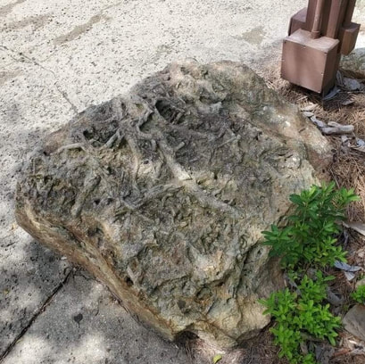
Glendon Limestone on top of a hill at the Ridgeland Bike Trails. The Limestone is full of fossil shells and shark teeth.
|
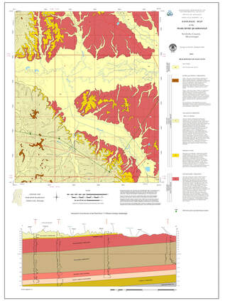
Geologic Map of the Ridgeland Quadrangle, Madison and Hinds Counties, MS. Ridgeland is a region of rugged sandy terrain capped by limestone vistas seemingly isolated in the middle of the Jackson Prairie. This set of hills owes its existence to the structural influence of the deeply buried Jackson Volcano. The headwaters of Purple Creek, White Oak Creek, Hanging Moss Creek and other tributaries form from a spring along the Forest Hill outcrop and then drain in almost parallel fashion across the Yazoo Formation towards the Pearl River. These creeks cut through the limestones and sands until they hit the Yazoo Clay. The creeks cannot easily incise into the clay so they migrate laterally within their large, shallow flood plains. This area of Ridgeland is remarkable because it is part of the drainage divide between the Big Black River and the Pearl River. The uneven cover of loess, wind-blown glacial silt, in the area makes for rich soils hosting interesting and diverse native plant and animal communities.
|
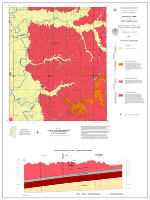
Geologic Map of the Whites Quadrangle, Rankin, Simpson, Hinds and Copiah Counties, MS
|
|
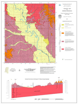
Geologic Map of the Hopewell Quadrangle, Copiah and Simpson Counties, MS
|
|
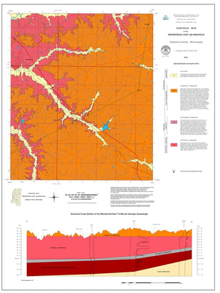
Geologic Map of the Mendenhall East Quadrangle, Simpson County, MS
|
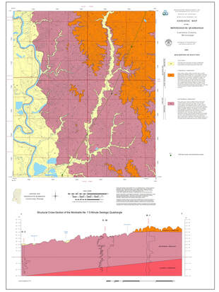
Geologic Map of the Monticello NE Quadrangle, Lawrence County, MS.
|
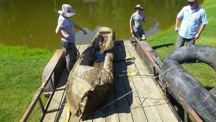
Photo courtesy Clarion Ledger. Read story here: https://www.clarionledger.com/story/news/2014/08/26/historic-canoe-removed-pearl-river-bank/14645661/
|
Geologic Map of the Monticello NE Quadrangle, Lawrence County, MS. Map depicts the Pearl River near Monticello, MS as the river cuts through Pliocene ancestral Tennessee-Ohio River terraces. The Brookhaven Terrace, named for gravels in Brookhaven, MS, occurs above 400 feet in elevation. On this map, the "Citronelle Formation" is any elevation higher than 400 feet. Just south of this map area, MDEQ worked along with the Mayor of Monticello to remove from the river a historic logging canoe dating from the mid-1800s. The canoe was donated to the Lawrence County Regional History Museum.