Ross Barnett Reservoir
History
|
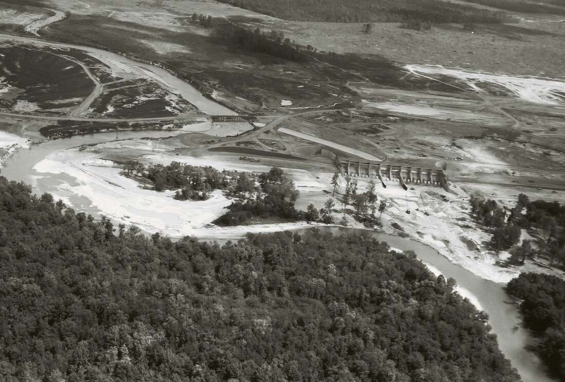
Construction of the 33,000-acre Ross Barnett Reservoir began in 1960 by MWH Engineering under the direction of the Pearl River Valley Water Supply District (PRVWSD). The main purpose of the infrastructure project was to create a permanent drinking water source for the Mississippi capital city of Jackson. Construction on the lake was completed in 1963, and the water level reached average capacity in 1965. The Reservoir's 3.5 mile-long man-made earthen dam is monitored and controlled from an electrical/mechanical spillway and gate system.
|
By the Numbers
-33,000 acre Reservoir, 45 miles long with 105 miles of shoreline
-Spillway gates: 40 feet wide x 20 feet tall, 8400 sq ft opening
-5 campgrounds, 16 parks, 22 boat launches, 3 handicapped-accessible trails, 2 multi-purpose trails
-Average depth: 12 feet, maximum depth: 60 feet
-PRVWSD maintains the Reservoir pool at a 297.5 feet (above sea level) during the summer
-In 2020, PRVWSD Board voted to keep the Reservoir pool at 296.0' in the winter months from November-March
-Normal minimum: 294', Historic low (since 1998): 293.23' in Oct 2000
-Normal maximum: 297', Historic high (since 1998): 298.64' on 28 Aug 2022
-Top of the seawall: 299'
-Extreme maximum: 300' (*to protect the dam, an emergency spillway is built to erode when topped at 300 feet (the gravel fuse plug self destructs))
-Maximum output of the 10-gate spillway: 170,000 cubic feet per second (cfs)
-Historic high output: 140,000 cfs during 1979 flood
-Minimum output: 240 cfs
-Guaranteed minimum flow stated in the operational permit: 173 cfs
-A 1.5" inch rise in the water level over the 33,0000 acre Reservoir takes 16,129,645,714 gallons of rainfall.
Pearl River Valley Water Supply District (PRVWSD)
The Pearl River Valley Water Supply District is the state agency responsible for managing the 33,000-acre Barnett Reservoir and the 17,000 acres surrounding the lake, 12,000 of which are forest land. The District carries out its multi-purpose mission without local tax dollars or general fund appropriations from the state legislature.
A 14-member Board of Directors, representing four state agencies and five counties, approves plans and projects for the District.
In 2005, Senate Bill 2805 by Senator Horhn proposed appointing 2 members from the City of Jackson to serve on the PRVWSD Board. Thise bill did not pass.
The Pearl River Valley Water Supply District is the state agency responsible for managing the 33,000-acre Barnett Reservoir and the 17,000 acres surrounding the lake, 12,000 of which are forest land. The District carries out its multi-purpose mission without local tax dollars or general fund appropriations from the state legislature.
A 14-member Board of Directors, representing four state agencies and five counties, approves plans and projects for the District.
- Two representatives each from Hinds, Rankin, Madison, Leake and Scott counties
- One member from the Mississippi Department of Environmental Quality.
- One member from the Mississippi Forestry Commission
- One member from the Mississippi Department of Health
- One Member from the Mississippi Department of Wildlife, Fisheries and Parks
In 2005, Senate Bill 2805 by Senator Horhn proposed appointing 2 members from the City of Jackson to serve on the PRVWSD Board. Thise bill did not pass.
River Flooding

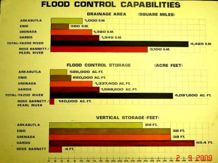
Unlike other Mississippi reservoirs, the Ross Barnett has little flood storage capacity. Since the regular Ross Barnett Reservoir pool is 297' and the emergency spillway blows at a pool of 300', a rise of only a few additional feet in the Reservoir water level can cause a catastrophic collapse. Although Ross Barnett Reservoir was not built as a flood control reservoir, Pearl River Valley Water Supply District does include mitigating flood events in the District, the upper river, and downstream as part of its management responsibilities.
Following the 1979 Easter flood, which left much of greater Jackson underwater, a report by the United States Comptroller's office found that the impact of the flood was partly due to a lack of communication between local, state and federal agencies. The report outlined that no "lines of communication nor coordination procedures had been established between the reservoir manager and the Corps, even though the reservoir's discharge rate could affect the flood-fighting responsibilities of the two entities." Since that time the Mississippi Valley Division of the Corps of Engineers, the City of Jackson, PRVWSD, the National Weather Service, as well as other involved agencies, have cooperated to manage Reservoir pool level while also working to reduce the river crests at downriver locations.
Following the 1979 Easter flood, which left much of greater Jackson underwater, a report by the United States Comptroller's office found that the impact of the flood was partly due to a lack of communication between local, state and federal agencies. The report outlined that no "lines of communication nor coordination procedures had been established between the reservoir manager and the Corps, even though the reservoir's discharge rate could affect the flood-fighting responsibilities of the two entities." Since that time the Mississippi Valley Division of the Corps of Engineers, the City of Jackson, PRVWSD, the National Weather Service, as well as other involved agencies, have cooperated to manage Reservoir pool level while also working to reduce the river crests at downriver locations.
During heavy rain events, the PRVWSD Manager coordinates closely with the National Weather Service, the Lower Mississippi River Forecast Center in Slidell, the U.S. Geological Survey, the U.S. Army Corps of Engineers, and the City of Jackson to adjust the discharge rate from the Reservoir. The team monitors weather forecasts along with river gauge readings upstream of the Reservoir at Carthage, Lena, and Ratliff Ferry, and downstream gages to Louisiana.
During the Feb 2020 major flood event, proactive and deft management of the Ross Barnett Spillway by the Pearl River Valley Water Supply District and its state/federal partners allowed the Pearl River to crest lower than originally forecast. Still, significant damage occurred in the City of Jackson and in downriver communities. The federal disaster declaration for the February 10-18 flood event covered 14 counties: Attala, Carroll, Claiborne, Clay, Copiah, Grenada, Hinds, Holmes, Issaquena, Leflore, Marion, Sharkey, Warren and Yazoo. These counties sustained significant damage to public buildings, private homes, highways and roads.


