
|
The USACE's Pearl River Flood Risk Management planning document proposes two main Alternatives for Jackson flood risk management: Alternative D (damming and excavating the river, price tag $500-650 million) or Alternative A1 (non-structural elevations and floodproofing, price tag $50 million). Why is Alternative D so expensive? That plan includes funding to build a new dam, not for flood control but to create a lake for economic development. Alternative D's budget includes hundreds of millions for required environmental mitigation, bridge countermeasures, and for building the new dam, new pumping stations and slurry walls to protect the current levees. Instead of funding flood risk management for our tributaries, Alternative D prioritizes a new lake and commercial development in the flood plain.
At the USACE public meeting in Slidell on July 11, residents asked the Corps of Engineers and the Rankin-Hinds Pearl River Flood and Drainage Control District about whether there would be new development along the dammed lake. Their answers conflict. Read the transcript excerpt here: JACK SESSIONS (private citizen): Now, I ask them today is there going to be houses out there –- are y’all going to let houses be built on these lakes? Can anybody answer that? UNIDENTIFIED SPEAKER: That’s a yes. JACK SESSIONS (private citizen): Because they said from day one that this was strictly going to be flood control, no houses whatsoever. So at the last meeting, I asked that and nobody can answer it. So today, I’m asking it again: are y’all going to let houses be built on this? BRANDON DAVIS (USACE): So to answer your questions, the Corps of Engineers is not –- I guess we’re not going to allow houses to be built on that. That land is going to be acquired through our real estate easements arm. The recreation that we’re talking about is boat ramps, bike paths, things of that nature. So the Corps of Engineers is not in the business of residential development or anything of that nature, so that’s –- I wouldn’t see that being there. JACK SESSIONS (private citizen): So no houses? Okay. TOM SHAW (USACE): Thank you. HOWARD PAGE (private citizen): Yes, sir. My name’s Howard Page, and a question that was asked just before this gentleman spoke –- I would like –- I saw that the gentleman from Rankin-Hinds, the local sponsor, I would like him to answer the question: are any houses going to be built because of this project? My understanding has always been absolutely, yes, this is absolutely a real estate development project. And so I was wondering if we could hear directly from you, if you agree. No one ever thought the Corps was going to build houses, so that really wasn’t the answer I was looking for. So I was wondering if this gentleman could answer that question. UNIDENTIFIED SPEAKER: Good job. KEITH TURNER (Rankin-Hinds Pearl River Flood and Drainage Control Disctrict): So first off, this has never been a real estate project, contrary to what many people say. This has always been a flood risk management project from the very beginning, but we’ve also stated from the very beginning that if there are ancillary benefits such as recreation or others, or some economic development, that’s a good thing for the city of Jackson. So there are no plans right now. There are no specific plans for any development of any sort. What we envision is that the communities that this project has improved as a result of the lake, that a planning process would occur with the communities to develop three areas specifically. One would be, obviously, recreational areas, natural areas, and then some areas would be opportunities for economic development. That area under D is much smaller than it was under C, but again, there’s no specific plans of any sort. And one thing that’s really important to understand is that the property acquisition, as Brandon mentioned, would be controlled by these parties right here. We’re responsible, as local sponsors, to actually acquire the property, and it would be controlled by us, and it would not be windfalls for developers of any sort. But specifically, the three areas –- recreation, natural, and some economic development. HOWARD PAGE (private citizen): So basically, yes, there is potential for development? UNIDENTIFIED SPEAKERS: (Multiple voices) Yes. KEITH TURNER (Rankin-Hinds Pearl River Flood and Drainage Control District): Yes. Yes, if it’s possible, there may be some development there. Now, I didn’t say houses and things, no –- there’s nothing planned of any sort. I’d be glad to talk with you in more detail outside and I can show you those specific areas. They’re not that large, and you know, whether they occur or not, I think it depends on whether the economy supports this thing or not. 45 years of Flood Risk Management (FRM) efforts for Jackson and 4 separate Lake projects
The human cost of betting on another Lake project Consider the human cost of going down another labyrinthine Lake path. Just 4 years ago, in 2020, residents in NE Jackson suffered through evacuations and returned to homes inundated with up to 4 feet of floodwaters. Flood insurance costs increase every year and many homeowners are only able to purchase partial flood insurance. Hurdles to approving a Lake project Alternative D, the new Lake plan, has the same problems as the "One Lake" plan that was found to be "not feasible". It is prohibitively expensive, above the maximum budget threshold allowed by Congress; according to USFWS, it could require a potential $1 billion+ in environmental mitigation costs; it disturbs hazardous waste sites that will introduce contaminants to our drinking water source; according to MDOT, it could cause failure of 7 bridges including I-20 and I-80; and it will CAUSE flooding of up to 5" or greater at first floor elevation to 52 structures in federally-designated “disadvantaged communities”. With rapidly rising flood insurance costs and the threat of further flooding, residents literally cannot afford to wait. The CTO Alternatives D and E will require a lengthy process of additional NEPA (National Environmental Policy Act) studies and analysis. Many critical studies and analyses are missing or incomplete in the 2024 USACE DEIS. The USACE states in the document that many of the studies required NEPA process will not be conducted until the Pre-Construction, Engineering, and Design (PED) Phase, which occurs after the USACE Assistant Secretary of Civil Works makes his Record of Decision about the project. A few of the further required studies are listed below. None of these studies will be required for Alternative A1.
Last week, the US Army Corps of Engineers (USACE) released the 2024 Pearl River Flood Risk Management (FRM) Draft Environmental Impact Statement (DEIS). The Rankin Hinds Pearl River Flood and Drainage Control District (Drainage District) has endorsed USACE Alternative D, CTO (combination thereof) with weir, an altered version of the "One Lake" project. According to the USACE "Commander's Report" released with the DEIS, the "Projected First Cost" for Alternative D is $100-$200 million higher than the "Total Authorized Project Cost".
Currently, only $221 million out of the $487-$655 million needed for the "New Lake" has been funded. In 2022, Senator Wicker received a $221 million federal appropriation of Bipartisan Infrastructure Law funding for the Pearl River Flood Risk Management project. This funding will be used to pay for the federal cost-share of the project. According to the "Commander's Report", the Non Federal Sponsor (NFS)(Drainage District) shall contribute 35 percent of total project costs, and the NFS shall not use Federal funds to meet its obligations. Drainage District cost share for the "New Lake" ranges from $140-$178 million. (The $221 million in federal funding cannot be used to pay for the Drainage District cost share.) The Drainage District has not indicated how they will pay for their portion of the project costs.* The local Drainage District Board of Directors includes the Mayors of Jackson, Flowood, Richland, and Pearl, representatives from the Hinds and Rankin County Boards of Supervisors (Supervisors Robert Graham and Jay Bishop), and a Governor-appointee. The Governor-appointee position on the Board has been vacant since January 2021. Drainage District revenues are obtained through a 4.75-mil tax assessment on properties protected by the levee system. The majority of the tax revenue comes from properties located in Rankin County. The state-owned properties on the Jackson side of the Pearl River do not pay this tax. A Drainage District spokesperson stated in 2018 that "Property owners who benefit from the One Lake Project would likely face a special assessment tax if the estimated $340 million project becomes reality." It is unlikely that special assessment taxes could raise enough funding to pay for the $140-$178 million local cost-share for the "New Lake".* Who will pay for the "New Lake"? (*Drainage District spokespersons did not respond to requests for information regarding project funding.) After the 1979 Easter Flood, one of the most costly and devastating floods in Mississippi, Congress authorized the US Army Corps of Engineers (USACE) to develop flood control plan for Jackson. Flood control planning for Jackson reached a stalemate decades later when the USACE Comprehensive Levee Plan and the local Two Lakes Plan were both rejected. In 2001, the USACE relinquished control and the local Levee Board took over responsibility for planning a Jackson flood control project. The Levee Board published the LeFleur Lakes Plan, a flood control and economic development plan which, despite numerous modifications was rejected by the USACE due to unacceptable cost and environmental impact. After decades of reviewing failed local lake plans, in 2010, the USACE wrote a letter to the Levee Board stating that the Corps will not resume any further study of flood control for the purpose of considering any lake alternatives or private development features. In 2009, the Levee Board, led by Flowood Mayor Gary Rhoads voted to move ahead with the USACE Comprehensive Levee Plan. Despite the Levee Board vote and admonishments by the Corps, in 2011, John McGowan and other local developers persist in forming the Pearl River Vision Foundation, a non-profit dedicated to promoting another lake development idea called One Lake. 7 years and millions of dollars of local, state, and federal funds later, in 2018, the Levee Board released their Draft Environmental Impact (DEIS) report, which includes their "preferred plan", Alternative C, the One Lake plan. In 2022, 43 years after the Easter Flood, the USACE is charged with completing the data gaps in the Levee Board's DEIS/FS to inform the Assistant Secretary of the Army (Civil Works)'s final decision on Jackson flood risk management. In 2023, the USACE released a Notice of Intent to publish a Pearl River Flood Risk Management DEIS/FS. Flood management options being evaluated include non-structural alternatives, hybrid options, and Alternative C ("One Lake"), the Levee Board-preferred plan. The USACE scheduled DEIS release for Sept 1, 2023. Flood management for Jackson again hits a stalemate. On August 8, 2023, Watkins & Eager, the Levee Board's law firm received a copy of a USACE Internal Presentation outlining the Corps estimated "One Lake" cost ($1.3-2.1 billion) and cost/benefit analysis of "One Lake". On August 31, 2023, USACE announced 1st delay of DEIS. An October 5, 2023, WLBT newspaper article quotes Keith Turner, the Levee Board's Watkins & Eager attorney, saying that USACE Secretary Connor's decision to delay the release, "wasn’t due to the lack of funding. Instead, it was made at the behest of the Rankin-Hinds flood district." On Oct 21, 2023, USACE announced 2nd delay of DEIS citing lack of funds. Updates in December 2023 and March 2024 provided no timeline for release of the DEIS. 2024 Pearl River Flood Risk Management Draft Environmental Impact Statement Many critical studies and analyses are missing or incomplete in the 2024 USACE DEIS. The USACE states in the document that many of the studies required under the National Environmental Policy Act (NEPA) process will not be conducted until the Pre-Construction, Engineering, and Design (PED) Phase, which occurs after the USACE Assistant Secretary of Civil Works makes his Record of Decision about the project. It will be difficult for agencies and the public to fully assess and understand the project Alternatives without this information. Additional NEPA studies and analysis will further delay flood risk relief for Jackson. In the 1960s, the Corps of Engineers built 13 miles of levee on the Pearl River in Jackson and straightened 13 miles of winding river and wetlands into a 2.1-mile stretch between Jackson Waterworks and the Coliseum. 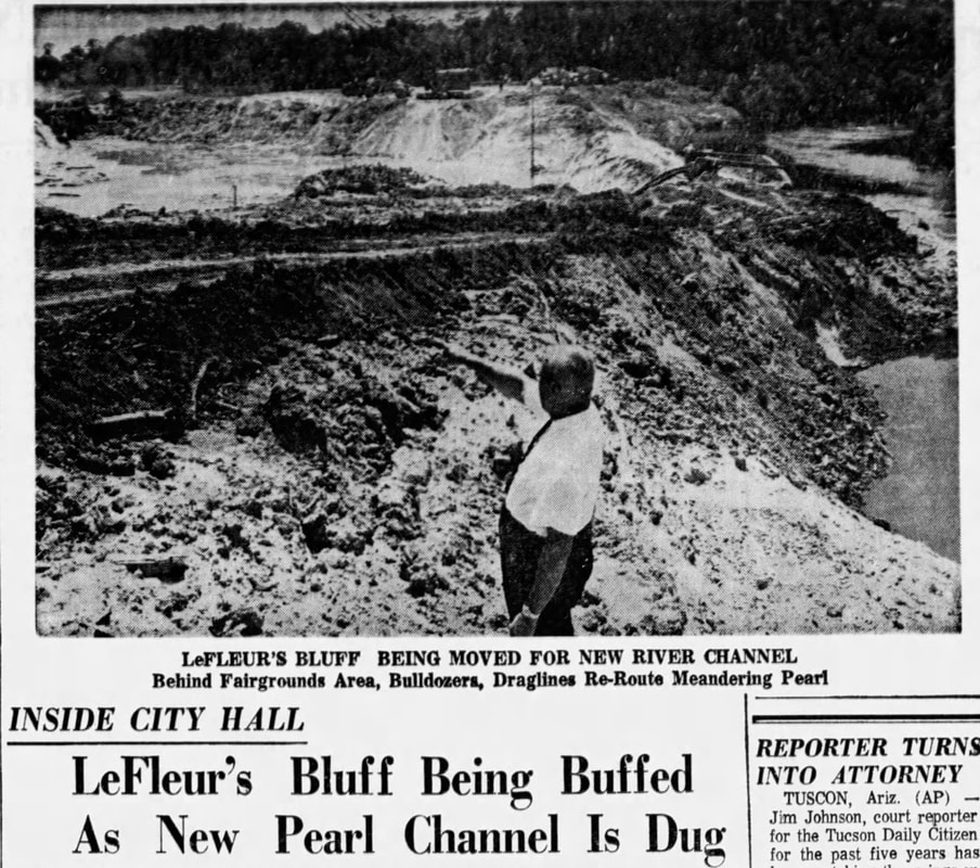 Clarion Ledger, 06 Jun 1965 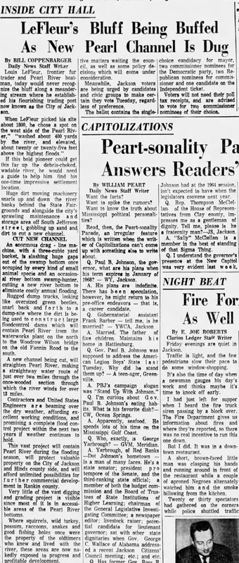 Clarion Ledger, 06 Jun 1965 Clarion Ledger, 06 June 1965: "Huge dirt moving machinery snarls up and down the riverbanks behind the State Fairgrounds and alongside the city’s sprawling maintenance and storage area off South Jefferson street, gobbling up sand and dirt to cut a new channel. An enormous drag-line machine, with a three-cubic yard bucket, is slashing huge gaps out of the swamp bottom once occupied by every kind of small animal species and an occasional river bottom swamp-hunter, cutting a new river bottom to eliminate costly annual flooding." "Rugged dump trucks, looking like oversized green beetles, snarl back and forth to a dump-site where the dirt is being used to construct large floodcontrol dams which will contain Pearl River from the waterworks plant on the north to the Woodrow Wilson bridge on the Old Fannin Road to the south. A new channel being cut, will straighten Pearl River, making a straightaway water route of just over two miles through the once-wooded section through which the river winds for over 13 miles." "This vast project will contain Pearl River during the flooding season, will protect valuable property on the City of Jackson and Hinds county side, and will afford unlimited possibilities for further commercial development in Rankin County. Very little of the vast digging and grading project is visible since most of it is inaccessible areas of the Pearl River bottoms. Where squirrels, wild turkey, possum, raccoons, snakes and good fishing holes were once the property of oldtimers who knew and lived with the river, these areas are now nakedly exposed to progress and profitable development." 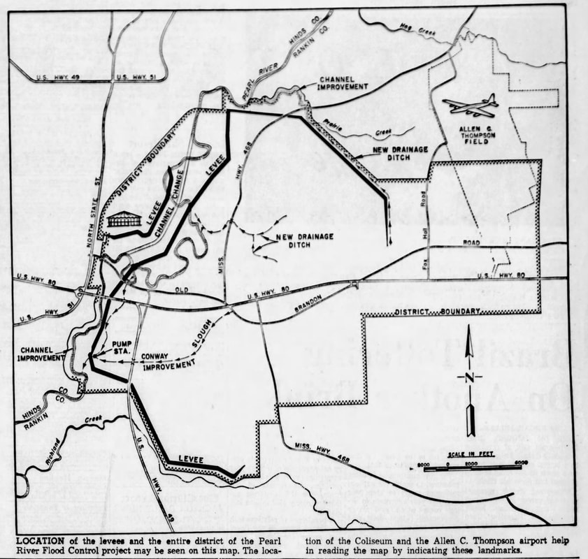 "Location of the levees and the entire district of the Pearl River Flood Control project may be seen on this map. The location of the Coliseum and the Allen C. Thompson airport help in reading the map by indicating these landmarks." Clarion Ledger, 12 Jan 1964 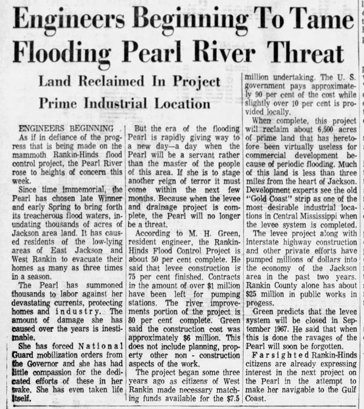 "Engineers Beginning to Tame Flooding Pearl River Threat" "But the era of the flooding Pearl is rapidly giving way to a new day-a day when the Pearl will be a servant rather than the master of the people of this area...Because when the levee and drainage project is complete, the Pearl will no longer be a threat." "When complete, this project will reclaim about 6,500 acres of prime land that has heretofore been virtually useless for commercial development because of periodic flooding. Much of this land is less than three miles from the heart of Jackson.""Green predicts that the levee system will be closed in September 1967. He said that when this is done the ravages of the Pearl will soon be forgotten." Clarion Ledger, 24 Jan 1966 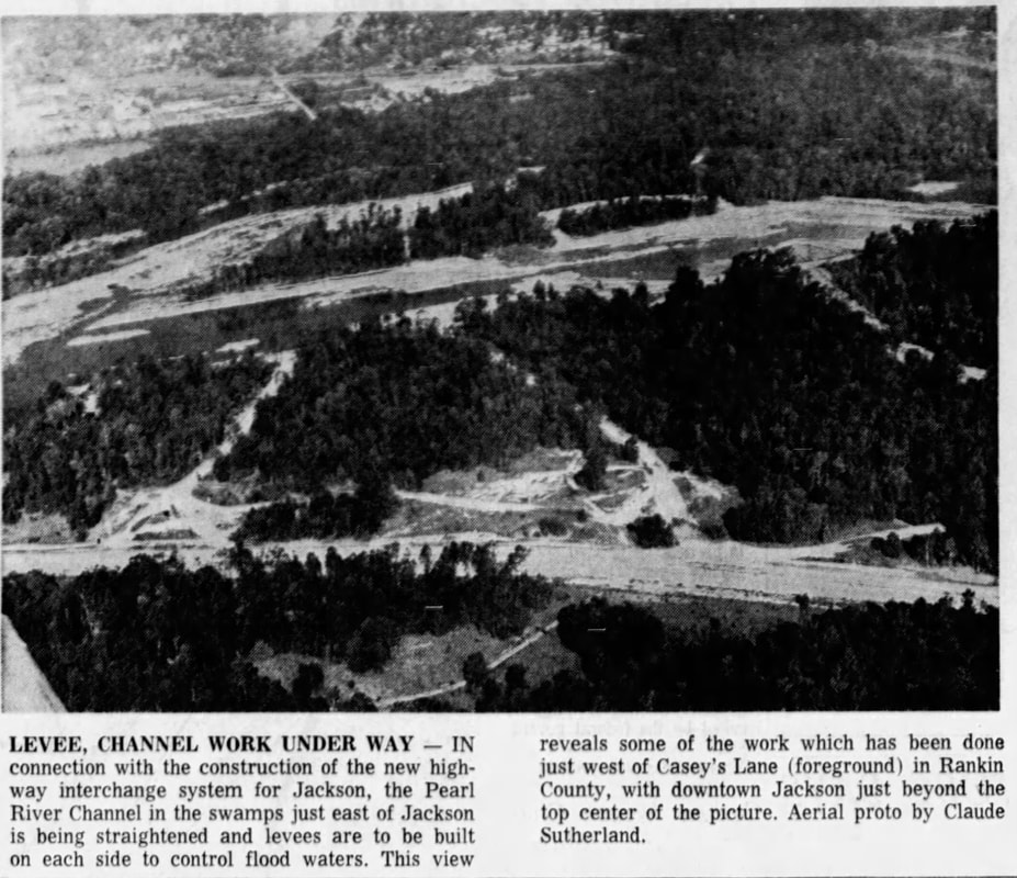 "Levee, Channel Work Under Way - In connection with the construction of the new highway interchange system for Jackson, the Pearl River Channel in the swamps just east of Jackson is being straightened and levees are to be built on each side to control flood waters. This view reveals some of the work which has been done just west of Casey's Lane (foreground) in Rankin County, with downtown Jackson just beyond the top center of the picture. Aerial photo by Claude Sutherland." Clarion Ledger, 28 Sept 1965 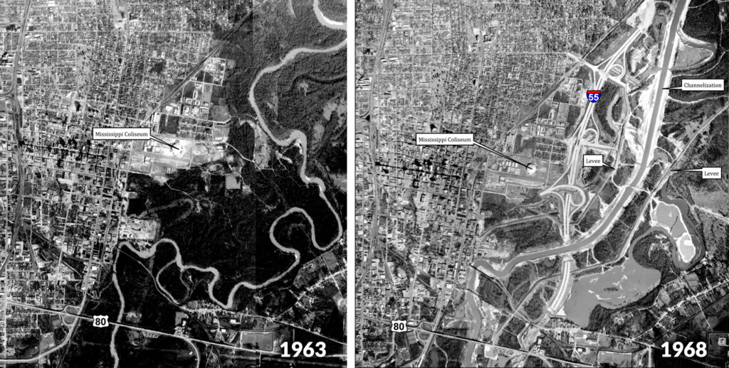 Photos: Rankin-Hinds Pearl River Flood and Drainage Control District
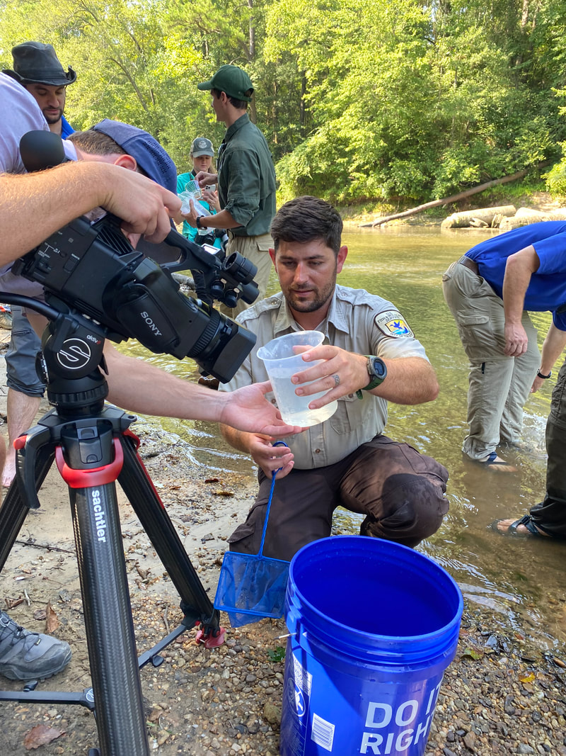
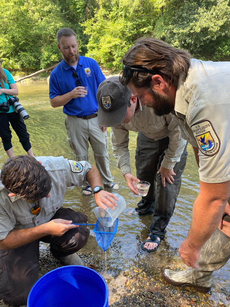
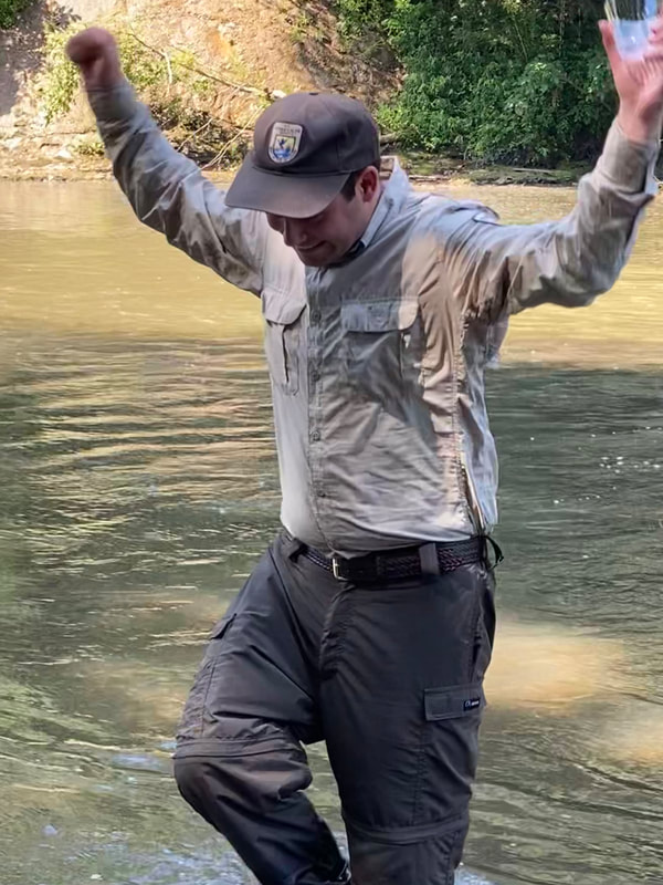
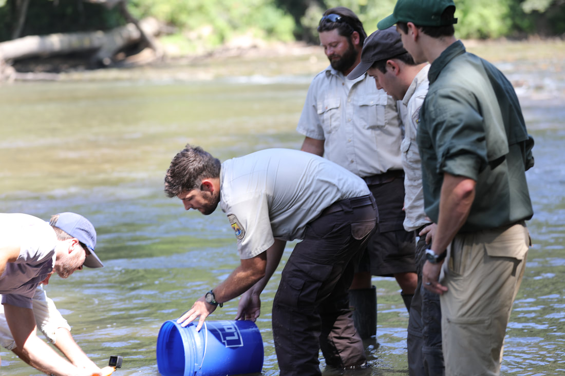
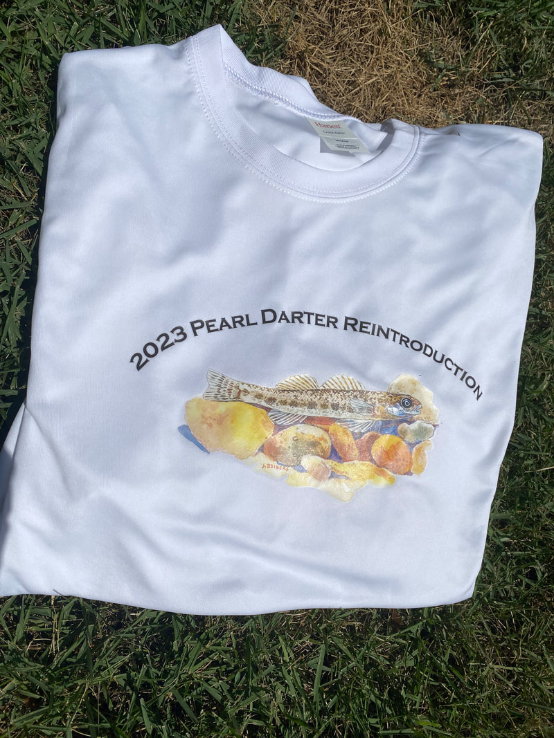
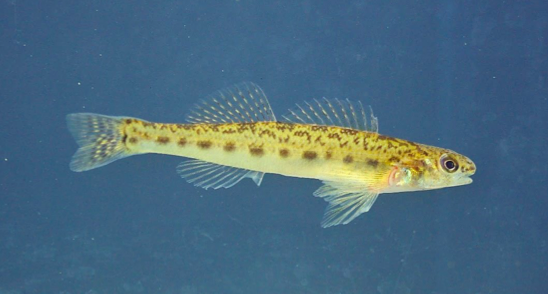
50 years after the establishment of the Endangered Species Act and 50 years after the last Pearl darter was seen in the Pearl River drainage, 39 Pearl darters were reintroduced to their native home!! USFWS's Matt Wagner called this event "the biggest win in his career as a biologist”. Pearl darters, now a federally threatened species, were once present throughout the Strong River and in the main stem of the Pearl as far south as I-10. Until today, the last remaining population lived in the Pascagoula River drainage. USFWS endangered species listing and recovery expert, Matt Wagner and team developed a Pearl darter recovery plan and designated a section of the Strong River as "critical habitat" for the fish. Over the past several years, brood stock from the Bouie River near Hattiesburg, MS, were collected and brought to the Private John Allen National Fish Hatchery in Tupelo for spawning. The Hatchery learned through much trial and error to successfully raise pearl darters and, today, 39 of the darters spawned this spring were released to the river!! The Pearl darter species recovery plan includes monitoring, surveying, and research of the species to ensure it can survive long-term in both the Pascagoula and Pearl River systems to the point that it is no longer threatened. Thank you, USFWS, Private John Allen Fish Hatchery, MDWFP and Strong River Camp for your dedication to biodiversity and conservation and for the opportunity to witness this rare, historic event. In late July 2022, the Rankin-Hinds Pearl River Flood and Drainage Control District (Levee Board) transmitted their One Lake Environmental Impact Statement (EIS) document to the Office of the Assistant Secretary of the Army for Civil Works ((ASA(CW)) for the next step in the One Lake project review process. The ASA(CW) and the federal Office of Water Policy Review have 30-45 days to review the document before sending it to other state and federal agencies for another 30-45 day review period. If the document passes these 2 sequential review periods, the document will be published to the Federal Register and available for a 30-45 public comment period. It has not yet been determined if the document would be published as another Draft EIS or as a Final EIS. Public comment could begin as early as October 2022. The US Army Corps of Engineers Headquarters is responsible for preparing final recommendations and conditions based on the state and federal reviews. 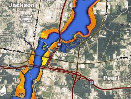 Many questions remain since the publication of the 2018 One Lake Draft Environmental Impact Statement (DEIS) including:
Pearl Riverkeeper will be looking for the answers to these questions and more upon the release of the next edition of the One Lake Environmental Impact Statement. **The Levee Board never publicly released the 2018 Independent External Peer Review or the 2018 US Army Corps of Engineers Agency Technical Review Summary Report. These 2 documents were obtained via FOIA request and can be viewed here: https://www.pearlriverkeeper.com/one-lake-agency-reviews.html 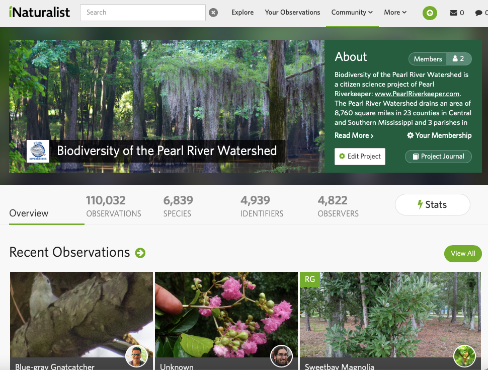 Pearl Riverkeeper is on iNaturalist! The iNaturalist app helps you ID the plants and animals around you and connects you with our local community of citizen scientists and naturalists. Download the app and register for your free account today. Existing and new members, join the Biodiversity of the Pearl River Watershed project to help us gather research quality data on the flora and fauna in our area. Any observation you make in the counties of the Pearl River watershed will automatically be added to our project. https://www.inaturalist.org/.../biodiversity-of-the-pearl...
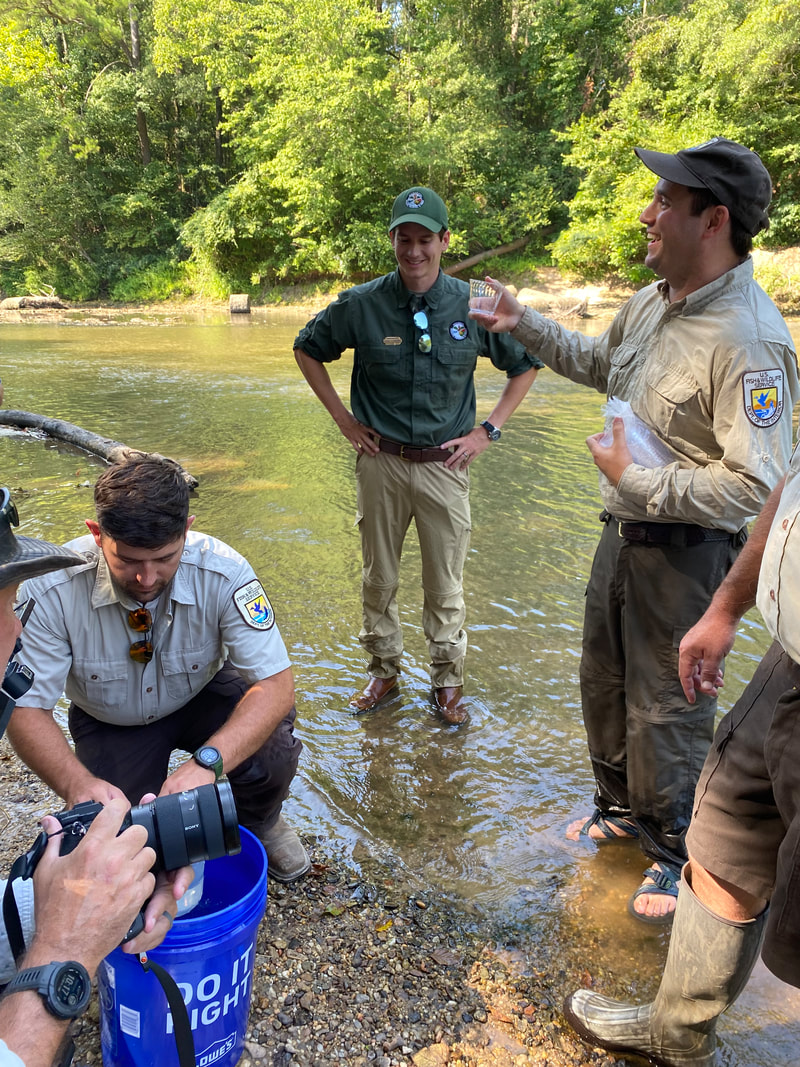
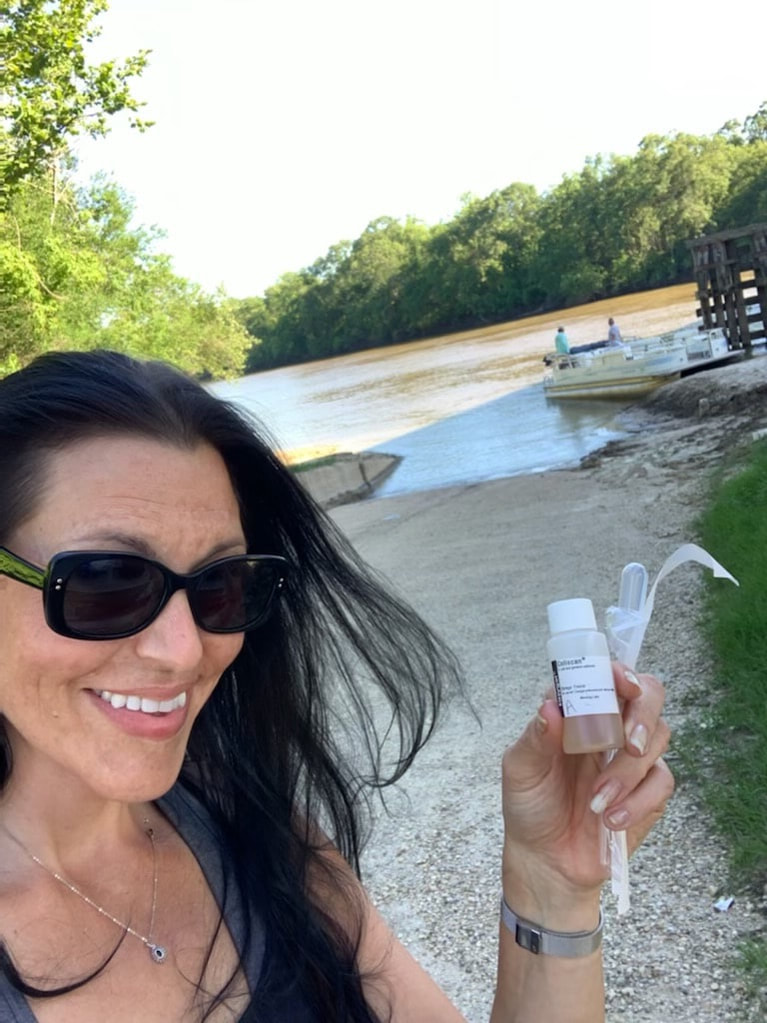
#WaterQualityWednesday is back!! Our dedicated water quality monitors are out in the watershed this summer protecting your right to clean water! Our volunteers collect valuable data for early detection of issues, determining changes over time and supplementing monitoring by government agencies. For their most recent water quality report, MDEQ was only able to assess 12% of MS rivers and streams and conducted no weekly bacteria testing on inland rivers and lakes. Pearl Riverkeeper volunteers are helping to fill the gap. Shout out to our members and Patagonia for financially supporting this crucial work. View our WATER TESTING RESULTS.
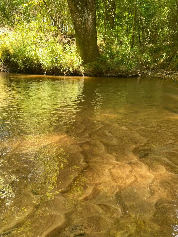
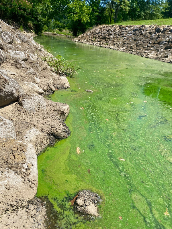 Intense heat, high nutrients (from fertilizers or sewer leaks), little rain and lots of evaporation are the perfect conditions for harmful algae blooms like this one on Brashear Creek in Madison. Algae blooms create low dissolved oxygen "dead zones" in the water which can potentially lead to fish kills. Some freshwater blooms are caused by cyanobacteria which have the potential to produce toxins that affect humans, pets, and our ecosystems. **Pets can get very sick and die within hours after swallowing toxins made by harmful algal blooms in bodies of water like lakes and rivers. Do not let your pets drink, play, or swim in water that has signs of a harmful algal bloom.
If you see an algae bloom, please report it to us here: https://www.pearlriverkeeper.com/report-pollution.html |
AuthorPearl Riverkeeper is a licensed member of the Waterkeeper Alliance, the largest and fastest growing nonprofit solely focused on clean water. Archives
July 2024
Categories |


 RSS Feed
|
Ready to support our work for Clean Water and Healthy Rivers?
|
|
Pearl Riverkeeper is a licensed member of the Waterkeeper Alliance, the largest and fastest growing nonprofit solely focused on clean water. |
|