
|
In the 1960s, the Corps of Engineers built 13 miles of levee on the Pearl River in Jackson and straightened 13 miles of winding river and wetlands into a 2.1-mile stretch between Jackson Waterworks and the Coliseum. 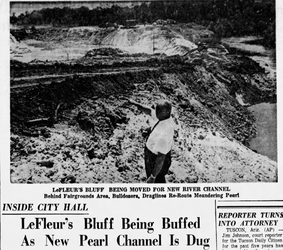 Clarion Ledger, 06 Jun 1965 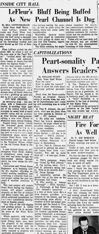 Clarion Ledger, 06 Jun 1965 Clarion Ledger, 06 June 1965: "Huge dirt moving machinery snarls up and down the riverbanks behind the State Fairgrounds and alongside the city’s sprawling maintenance and storage area off South Jefferson street, gobbling up sand and dirt to cut a new channel. An enormous drag-line machine, with a three-cubic yard bucket, is slashing huge gaps out of the swamp bottom once occupied by every kind of small animal species and an occasional river bottom swamp-hunter, cutting a new river bottom to eliminate costly annual flooding." "Rugged dump trucks, looking like oversized green beetles, snarl back and forth to a dump-site where the dirt is being used to construct large floodcontrol dams which will contain Pearl River from the waterworks plant on the north to the Woodrow Wilson bridge on the Old Fannin Road to the south. A new channel being cut, will straighten Pearl River, making a straightaway water route of just over two miles through the once-wooded section through which the river winds for over 13 miles." "This vast project will contain Pearl River during the flooding season, will protect valuable property on the City of Jackson and Hinds county side, and will afford unlimited possibilities for further commercial development in Rankin County. Very little of the vast digging and grading project is visible since most of it is inaccessible areas of the Pearl River bottoms. Where squirrels, wild turkey, possum, raccoons, snakes and good fishing holes were once the property of oldtimers who knew and lived with the river, these areas are now nakedly exposed to progress and profitable development." 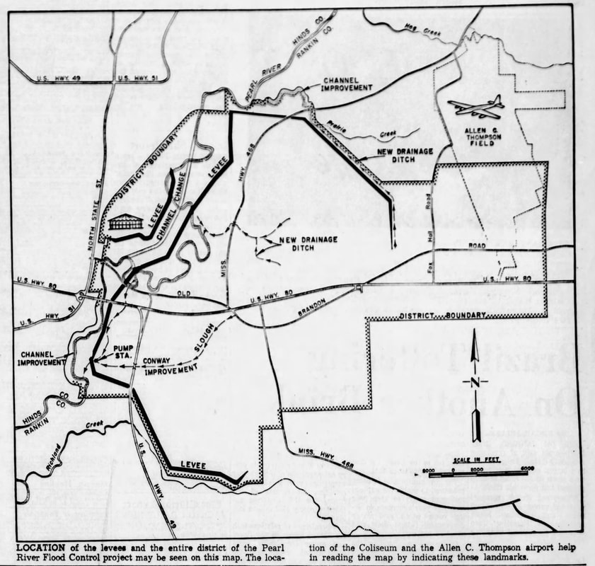 "Location of the levees and the entire district of the Pearl River Flood Control project may be seen on this map. The location of the Coliseum and the Allen C. Thompson airport help in reading the map by indicating these landmarks." Clarion Ledger, 12 Jan 1964 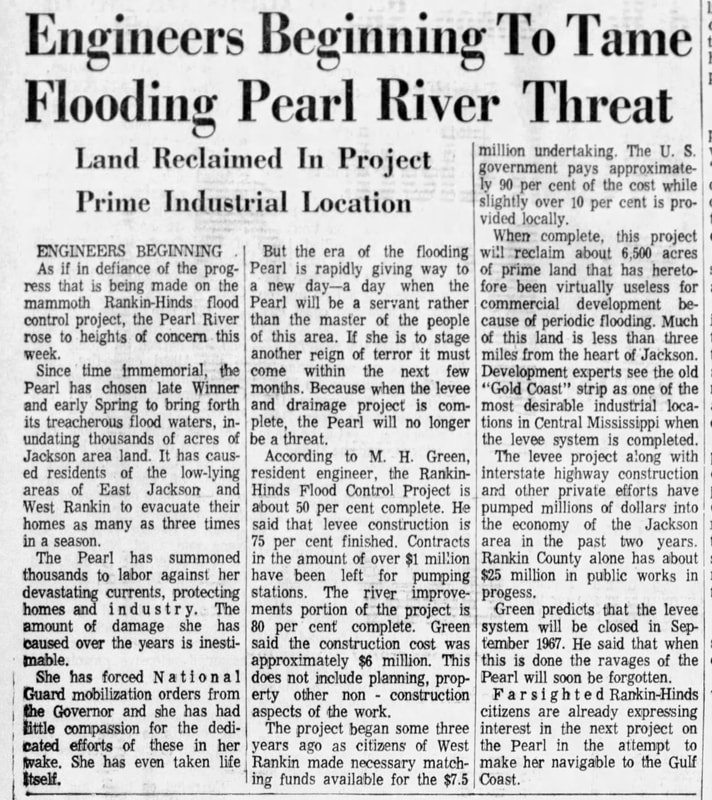 "Engineers Beginning to Tame Flooding Pearl River Threat" "But the era of the flooding Pearl is rapidly giving way to a new day-a day when the Pearl will be a servant rather than the master of the people of this area...Because when the levee and drainage project is complete, the Pearl will no longer be a threat." "When complete, this project will reclaim about 6,500 acres of prime land that has heretofore been virtually useless for commercial development because of periodic flooding. Much of this land is less than three miles from the heart of Jackson.""Green predicts that the levee system will be closed in September 1967. He said that when this is done the ravages of the Pearl will soon be forgotten." Clarion Ledger, 24 Jan 1966 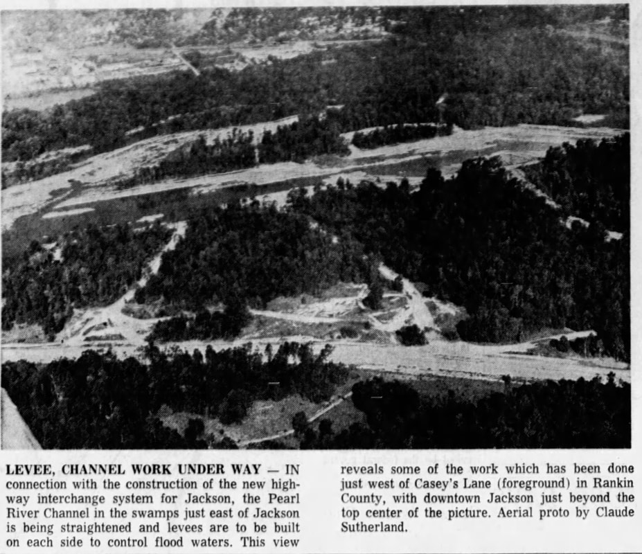 "Levee, Channel Work Under Way - In connection with the construction of the new highway interchange system for Jackson, the Pearl River Channel in the swamps just east of Jackson is being straightened and levees are to be built on each side to control flood waters. This view reveals some of the work which has been done just west of Casey's Lane (foreground) in Rankin County, with downtown Jackson just beyond the top center of the picture. Aerial photo by Claude Sutherland." Clarion Ledger, 28 Sept 1965 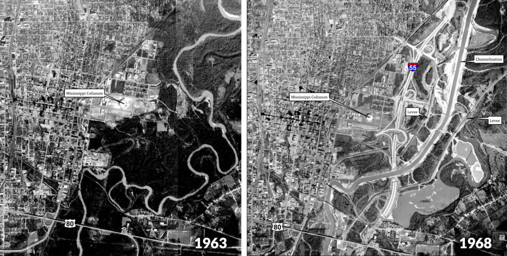 Photos: Rankin-Hinds Pearl River Flood and Drainage Control District
|
AuthorPearl Riverkeeper is a licensed member of the Waterkeeper Alliance, the largest and fastest growing nonprofit solely focused on clean water. Archives
July 2024
Categories |
 RSS Feed
|
Ready to support our work for Clean Water and Healthy Rivers?
|
|
Pearl Riverkeeper is a licensed member of the Waterkeeper Alliance, the largest and fastest growing nonprofit solely focused on clean water. |
|